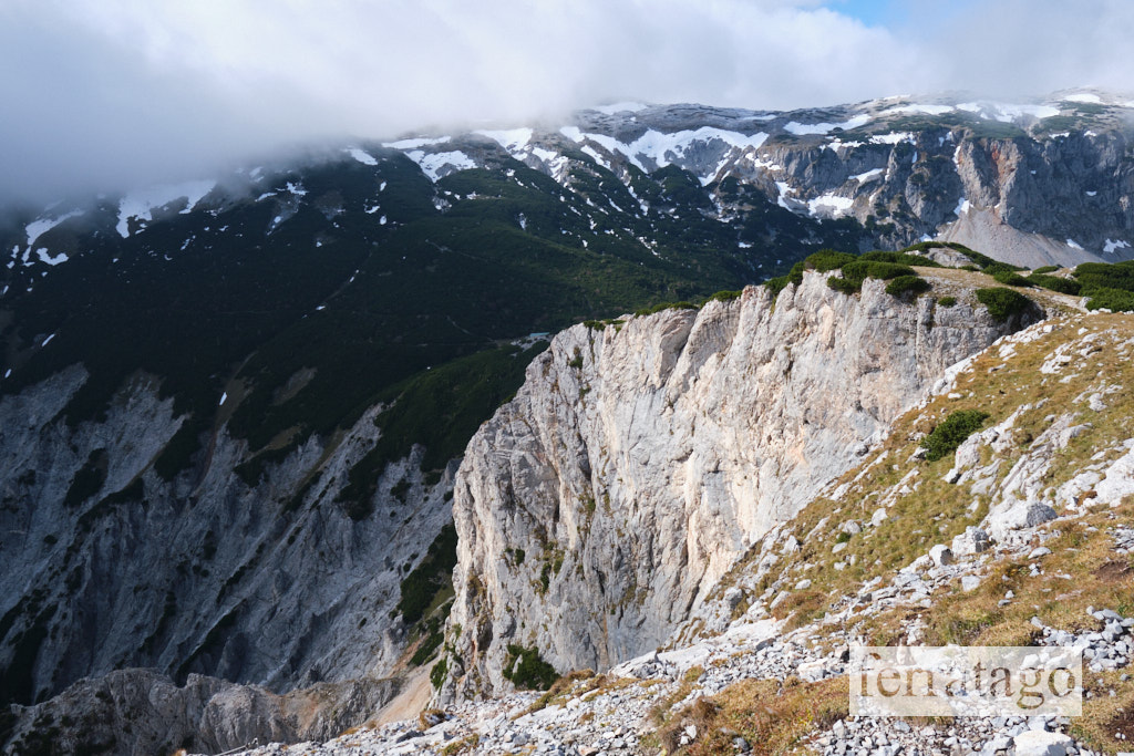
The Hans von Haidsteig via ferrata is considered a classic in the Rax-Schneeberg mountain range, part of the Northern Limestone Alps, located on the border between the Austrian provinces of Styria and Lower Austria. These mountains are often regarded as the “home mountains” for residents of Vienna, making this via ferrata a perfect option for a day trip from the Austrian capital.
Summary
Grade: D, 1
Vertical: 420m ferrata, 950m total
Time: 1h30min approach, 2h ferrata, 2h descent, 5h30min total
Access / Parking: 47.6835,15.7416 – Google Maps or any Android maps app
Start via ferrata: 47.6978,15.7342 – Mapy.cz or any Android maps app
Download gpx track
Map and photos
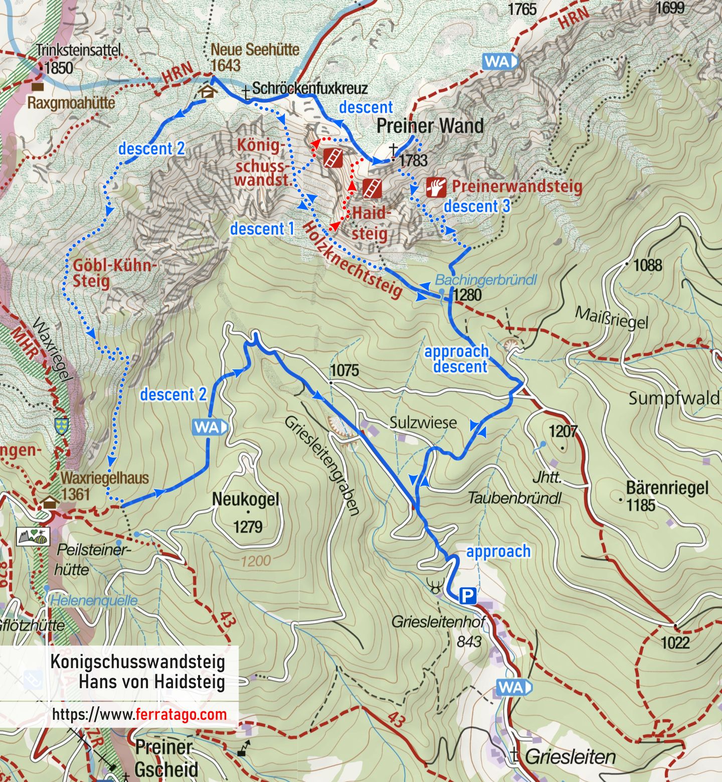


Access
We arrive by car in Prein an der Rax and, at the end of the village, turn right at the signpost for Klettergebiet Preinerwand. Follow the narrow road to its end, where parking is available before the forest road barrier.
Approach to start
The approach hike begins on the forest road past the barrier. We follow this road until the first bend, where we turn right onto the yellow-marked path that ascends steeply into the forest.
The yellow path crosses the forest road twice before arriving at a signposted intersection, where we meet the road again. Here, we turn right onto the green-marked path and follow it until we reach another signposted intersection.
At this point, we follow the signpost for Haid-Steig and turn left, continuing on the red-marked trail. This will lead us to the only water source on the path, Bachinger Bründl.
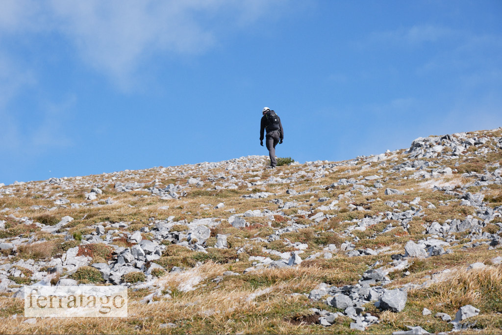
From there, we continue hiking on the Holzknechtsteig path, an easy traverse that ascends gradually. Soon, we’ll see the start of the via ferrata cable on our right, next to a plaque with the name of the route.
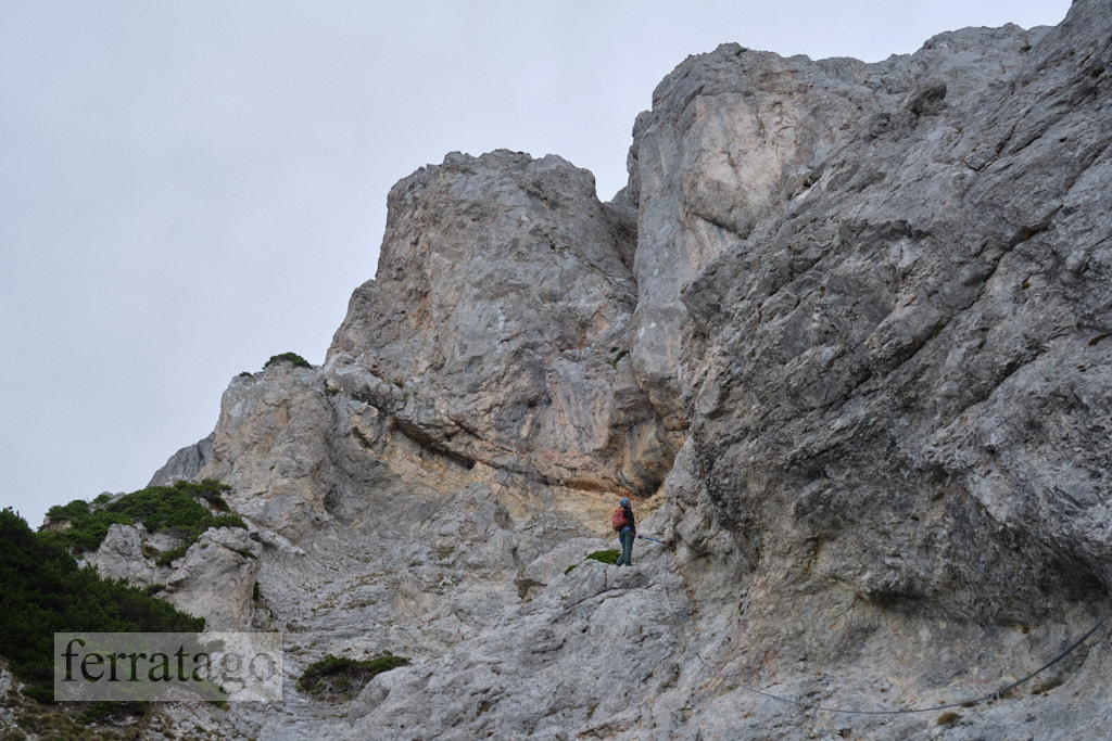
The route
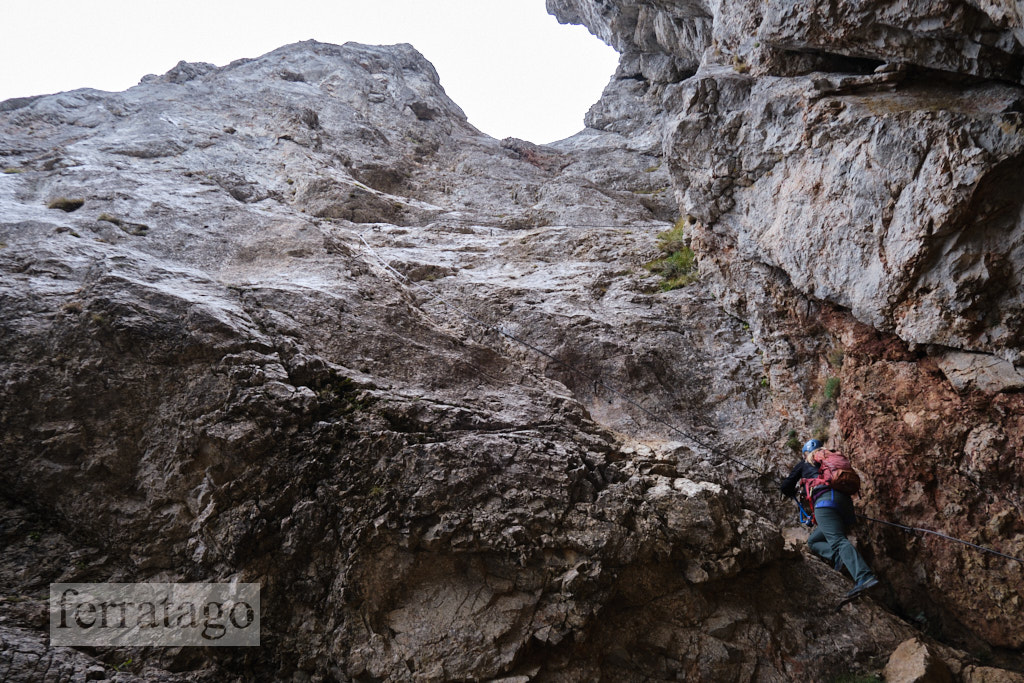
The Hans von Haidsteig Via Ferrata begins with a cable section, but we’ll quickly notice that the route alternates between cable-secured segments and easy scrambling, up to grade 1 difficulty.
In the lower part, we’ll climb an iron ladder shaped like a tree. A second tree-shaped ladder appears higher up, just before the most challenging section of the route.
After the second iron tree ladder, we’ll enter a rock basin filled with scree. If the rock is wet, the following sections can be slippery and will require careful footwork. A narrow segment in this area feels like a grade C/D when dry, but can reach grade D difficulty when wet.
Before the next scramble section begins, we can take a break near the Black Madonna statue (1585 m), where the climbing book is also located.
The well-planned route, along with the natural holds on the rock, makes the entire climb highly rewarding.
Descent
After the cable ends, there are three options for descent:
- via Holzknechtsteig: We head northwest-west toward Neue Seehütte, and before reaching the hut, we turn left onto the red-marked Holzknechtsteig path. After passing through the scree section, we’ll arrive back at the start of the via ferrata cable, from where we can retrace our steps to the car park.
- via Göbl-Kühn-Steig: Continue to Neue Seehütte and descend via the yellow-marked path all the way back to the forest road where our approach began. This is the easiest descent, though slightly longer.
- via Preinerwandsteig: Ascend to the summit of Preiner Wand at 1783 meters, then descend on the red-marked Preinerwandsteig (A/B). This path will lead us back to the Bachinger Bründl water source we passed on the approach. From there, we simply retrace our steps to the car park.
Good to know
- Both iron tree ladders were part of the original construction from 1921, a design by painter Gustav Jahn. They are similar to the iron tree on via ferrata Pittentaler.
- Slippery and dangerous when wet.
Donation box
I’m trying to keep this site ad free, supported by donations only via Buy Me a Coffee, PayPal or Bitcoin. Your support is highly appreciated.
Video
Weather
Main sources
- bergsteigen.com (German)
- we climbed the route on September 29, 2024