Zimmereben is a challenging via ferrata near Mayrhofen, situated in an area that features several other via ferrata routes with easier grades.
Summary
Grade: D/E
Vertical: 160m ferrata, 240m total
Time: 10min approach, 1h30min ferrata, 25min descent, 2h05min total
Access / Parking: 47.1752,11.8623 – Google Maps or any Android maps app
Start via ferrata: 47.1746,11.8599 – Mapy.cz or any Android maps app
Download gpx track
Map and photos
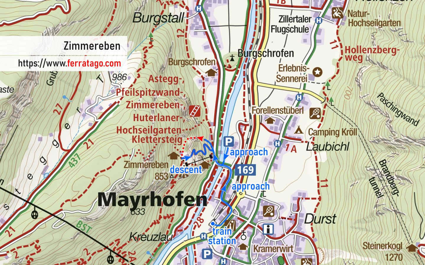


Access
By car, we arrive in the Zillertal valley coming from Jenbach toward Mayrhofen. Before entering Mayrhofen, we turn right and cross the Ziller river. We park in a small paid parking lot marked as “Klettersteige Mayrhofen Parkplatz” on Google Maps.
The villages and towns in Zillertal valley are well connected by train and buses. From Mayrhofen’s train station you can easily walk to the start. If you happen to be on a bike, there is a bike path that runs along the river, well separated from car traffic.
Approach to start
From the parking lot, we go south and find a detailed information board. We continue on the approach path, past the start of Huterlaner via ferrata, until we arrive at the base of the impressive rock where our route begins.
The route
The via ferrata is 450 meters long, featuring slabs and edge climbing, with a few slightly overhanging sections. Along the route, there are three resting areas and a three-cable bridge in the upper section.
Descent
After the cable ends, we arrive shortly at Zimmereben Gasthaus. From here, the trail called Huterlanersteig leads us back to the valley.
Good to know
- You can access more via ferratas from the same parking place.
- Inaugurated in June 2008.
Donation box
I’m trying to keep this site ad free, supported by donations only via Buy Me a Coffee, PayPal or Bitcoin. Your support is highly appreciated.
Video
Weather
Main sources
- bergsteigen.com (German)
- we climbed the route on August 21, 2019